Norway – Fjords – Journey to Trolltunga - Part 2

The trip was high on my husband’s bucket list. The man who could care less about travelling, expressed interest in doing some Norwegian hiking. We were only in Norway for 3 full days, so making the most of it was essential. Flying into Haugesund would have truly maximized the trip. It would have cut out about an hour of driving and using the ferry, but we would have missed some incredible views going this route.

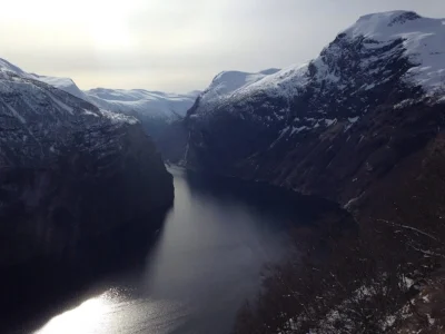
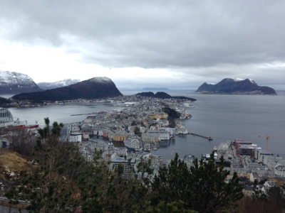
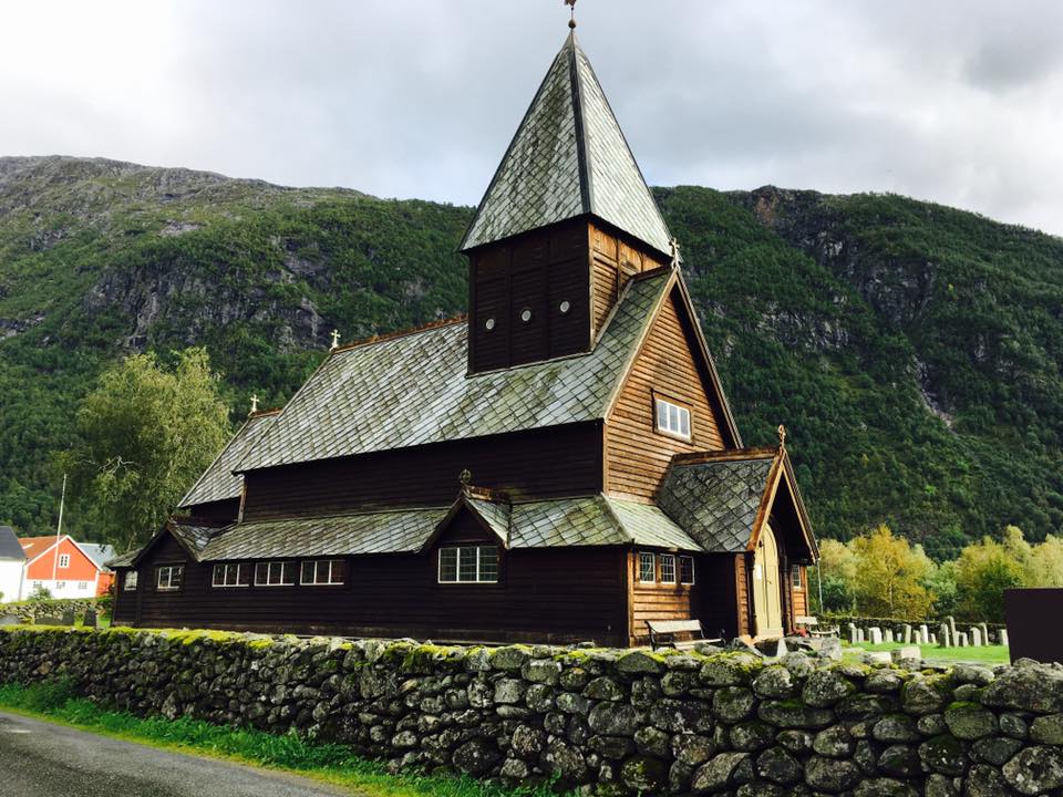
We started in Stavanger, arriving around midnight on Friday night. SIXT rental car staff will stay out of hours if you provide your flight information when booking. We stayed overnight near the airport in order to get a good night’s rest for the rest of the trip. Saturday morning we set off to Kyrping Camping. I chose this location as it was centrally located along the area we wanted to see. They offer a variety of accommodations to stay in, we chose one of the log cabins along the lake. The drive took about 3 hours with the ferry and winding roads from Sola Airport. There were so many lakes and gorgeous photo stops along the route. We were able to check in early, drop bags and headed towards Røldal. Røldal is known for having one of the oldest stave churches in Norway, dating back to 1200. https://www.visitnorway.com/listings/r%C3%B8ldal-stave-church/1267/

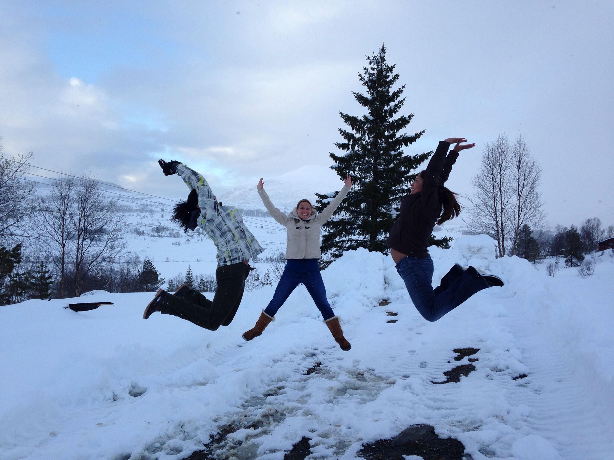
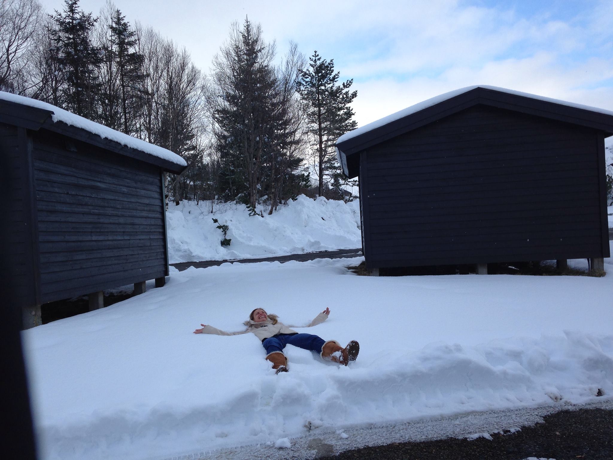
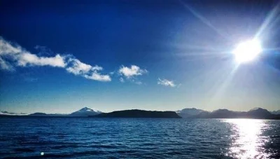
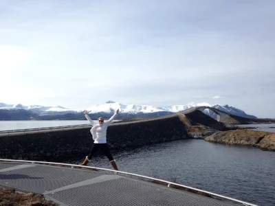
Breath-taking scenery

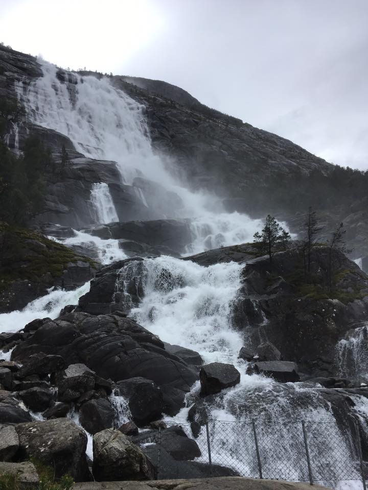
On the way to Røldal you will see numerous waterfalls, including Langfoss, also known as the 5th largest waterfall in Norway. It was voted in 2006, as the World’s Most Beautiful Waterfall. There is a hiking trail at the base to the top, which could be done in about 3 hours. We chose the photos from the bottom option due to the heavy off and on rain most of the day. There is a small parking lot next to the falls which offered a bathroom, snacks and souvenirs. https://www.visitnorway.com/listings/langfoss-waterfall/2135/

Upon arrival to Røldal there is signs for the church along the road. We arrived after they had closed for the afternoon, so a few photos of the exterior and we set off to Skjeggedal.

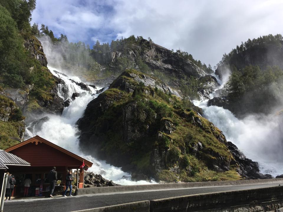
Along the road you will approach another large waterfall. The famous Låtefoss, also known as the twin waterfalls. It was quite the site to see. There is a waterfall a few hundred yards before Låtefoss that is likely to drench your car enroute. The waterfalls were definitely a highlight of our trip. https://www.visitnorway.com/listings/l%C3%A5tefoss-waterfall/1268/

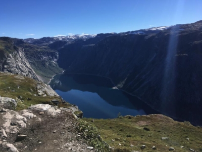
As we approached Skjeggedal we started to see signs for Trolltunga. We stopped in to assess where to park and where the start of the hike was. I had read numerous blogs leading up to the hike and wanted to know what to expect myself. We wanted no surprises at 6am for the start of the hike. We found that there is a large car park at the bottom of the hill which is 100NOK a day at the time of writing.

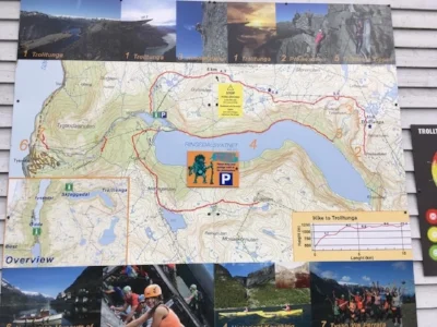
It is another 6km to the top from here. Many people were parked here, because in high season if you arrive late to the top carpark, you will have to park here and hike up the road to the top. The 6km road to the top was an adventure in itself. It is a single lane road along the cliff side.  Watching for cars and people that afternoon was quite the task. Once at the top you will find another carpark at the base of the hike. This one is hourly parking. We read some of the information on the signs and then headed back to the lodge for dinner and a good night’s rest.

https://goo.gl/maps/ZCeBDgkYgQt

Time to hike

Now here is where the adventure truly starts!!! Remember this was a family holiday and we have decided that it is a great idea to take our 11 year old on an expert level hike in Norway. When I say expert level, I mean grown men were turning back in the beginning realizing how under prepared they were. But, we were committed to making it up and down, and in one piece.

We woke up at 5am in order to make the 1 hour drive to the base of the mountain. We packed everything that was mandatory to hike in Norway. All listed here for your reference. https://www.visitnorway.com/listings/trolltunga/8625/

I had read the day before that the car park payment machine was broken. Many people waited until 8am when they opened to start their hike. We decided we were not waiting around 2 hours and paid once we came back. We paid 400NOK for the 12 hours we were gone. The area gets quite a bit of rain so expect a bit of mud. I do mean the thick pull off your shoes kind of mud. Everything I read about the hike stated that the 1st kilometer was the worst. They have closed the funicular to which offered stairs to the top. So the only way up was through a wooded path in the forest or a tour company using the sky ladder.

The 1st kilometer offered a variety of terrain and somewhat stairs along the way up made of rocks. The route up you will use ropes in numerous areas to pull yourself to the top.  I might have been a bit ambitious to get to the top and I rushed to the top. DO NOT do this! As much fun as this part of the route was, my 30 something body paid me back at the back end of the hike.

With the 1km done, I remember roughly the sign said 21km total for the hike. We proceeded up numerous mountains, across waterfalls, wood planks, rivers, mud, lots more mud, more water, cliff side drop offs, and sheer rock face. We took 10 minute breaks a few times, but overall snacked in route. 3-4 kilometers into the hike gets interesting again with lots of terrain changes. This was up there with the 1st kilometer in my book. Worn out and sore, but at 7.5 miles later, yes that 12 kilometers, we reached Trolltunga. We arrived just before 12 meaning it took just over 4 hours to get to the top. The view was incredible to say the least. The line was about 20 people back when we arrived. We agreed to swap out with others in line to take photos. If not we would not have been able to take a photo together. We spent just at an hour here with photos, lunch and a pee stop.

Thrilled with our achievement we headed back with our heads held high. At this point the overnight hikers and many others were all heading back at the same time. There was far more overtaking from experienced hikers. This made the way down much slower as many points it’s a small path along the mountain side. My knees two weeks later still remember the down portion like it was yesterday. At this point even changing out of wet socks and bandaging blisters was not doing the trick. I was tired and we had unusually great weather. That meant that all those layers we packed were wearing us down. The temperature peaked midday to about 85 degrees. We packed two water bottles and filled at each waterfall we encountered, which was quite often. So do not feel you have to pack tons as you can refill about every 2km along the route.

We reached 3-4 kilometers again and the mud was even worse than the way up. Over the hills, through the woods, waterfalls, rivers and mud for another 7.5 miles. We reached the last kilometer and this was my final breaking point. My knees were screaming from the down, down, down and more down. A marathon runner I am, a hiker I am not. The mud, people, terrain and ropes made the last kilometer one of those moments that you wished you got better trip insurance. But WE MADE IT!! We kissed each other, happy that not only that we completed the 25 kilometer trek, but that we FREAKING survived to tell about it. I lived up to my word and my kid got a Fanta and 2 kinder eggs for not complaining the whole time!!

My suck it up, you will survive maternal instinct was clearly on point with this trip.

I am a big goal setter and I used my Garmin Fenix to track the hike. You can find it here: https://connect.garmin.com/modern/activity/1344917714

We paid our parking and headed back to the camp ground. We were exhausted and starving, but totally excited for the opportunity to take on this amazing hike.

The next morning we headed into Stavanger for the day. The journey back to the airport was just as gorgeous as the way up. We parked next to the cruise port in the city following the “Old Town” signs. We visited the cathedral and the oldest part of the town. The old town area is filled with 100 white houses and cobblestoned streets. Perfect for an afternoon stroll to stretch out our legs. Enroute to the airport we stopped over to the Swords in the Rock for a photo op. https://www.visitnorway.com/listings/swords-in-rock/1852/

All in and all it was a good 3 day trip for the family. It offered a bit of everything for everyone. Fun, adventure, sites and relaxation.


Happy Traveling,


Katrina 

Norway – Fjords – North Atlantic Highway - Part 1

Norway – Fjords – North Atlantic Highway - Part 1

We have made the trip to Norway twice in the past year. Both times to see the fascinating waterfalls and landscape of the western Fjords. There are two things you should know about Norway. The conditions can change at any moment and that chances are year round you will encounter snow.


The first trip to Norway was in the end of April, over the Easter Break. There was a TON of snow in the region and people were still skiing up in the area where we stayed. Many of the hiking routes were closed and too dangerous to access. One thing I learned on this trip is that I clearly needed to do more research before heading to Norway. As a city break girl, I had underestimated the seasonal aspect of the region.

This was clear when I found that the ferries I had wanted to take were “seasonal,” which is from May 1st to August 31st in most regions in Norway. I share this because the things I wish I would have known, could have allowed us to maximize our 4 day trip. The main attractions were the city of Alesund, North Atlantic Highway, Geiranger Fjord, and the island of Runde.

https://goo.gl/maps/AAkkJAW44FE2

The use of the ferries in between the islands to the North Atlantic Highway, did not disappoint. In fact, it had me planning my next trip to the Fjords to see more. The island of Runde is known for puffins and when in season, this place is a bird watchers dream.

Geiranger Fjord was everything I could have imagined, but in frozen April the Seven Sisters waterfall we drove for hours to see, was well frozen. We drove through snow banks to get there and the way back down was rather interesting as we were caught in a snow storm. In the end we enjoyed our very snowy trip to the mountains. 

Alesund's viewing area provided a nice overview of the area and some history. This area was once used as a fortress, with numerous pill boxes and caves. In the summer, a cruise from the area is highly recommended. 

In the end it’s about the journey and not the destination. 

Happy Traveling, 

Katrina